Opportunities & Challenges
San Francisco remains the central axis of the Bay Area, although San Jose to the south outnumbers it in terms of population. It is a dynamic planning environment, with multiple civic projects going up at any given time. It boasts a diverse, active, and well-informed population, an excellent transit system, a thriving business district, and unique residential neighborhoods with mixed-use cores.
But San Francisco is not without its problems. Even though the dot-com boom is on its way out, housing in the city remains remarkably expensive, and like many cities the bureaucracy has on occasion stifled potential projects. In the San Francisco Charter, there is no such thing as as-of-right development, therefore all development is discretionary. This creates a contentious environment in which to do business, as no matter what the zoning may be for a given site, the project will still be subject to a vote.
Sites of major activity include SOMA (South of Market) and Bayview. For a long time, SOMA has been predominantly mixed-use zoning, which has allowed it to remain flexible to market demands. It currently contains a broad array of land uses in no particular pattern, yet it has excellent street-frontage and a strong urban environment. Because of its proximity to downtown and the relatively high number of developable lots, it figures to be central to the future growth of the downtown area.
Further south along the shore lies Bayview, a neighborhood that is looking to revitalize itself in conjunction with the Third Street Light Rail project. After serving as the shipbuilding center for San Francisco in World War II, it has been somewhat neglected by City Hall and mistreated by both the Navy (who maintained a toxic waste dump there) and PG&E (whose power plant is thought to contribute to the higher than average cancer rates). Geographically isolated, Bayview boasts a high home ownership average (50-60%) and a strong African American population in a city becoming increasingly white.
Selected City Policies
The city’s Planning Department has been focusing on a neighborhood improvement initiative called Better Neighborhoods 2002. In their own words, “the program is two-tiered. Citywide, it aims to encourage housing where it makes sense and to strengthen neighborhoods. Locally, the program uses intensive community-based planning to refine citywide goals to the needs of the neighborhood.” The program’s three pilot sites are the Central Waterfront, Octavia & Market, and Balboa Park Station. The program concentrates not only on giving residents an open forum to voice concerns, but also on educating the participants about what elements combine to make a good neighborhood.
Urban Ecology Activities
Neighborhood Planning
Urban Ecology’s Community Design Program conducted in a community planning process in Visitacion Valley in 2001. In the next few years, two major developments in San Francisco will transform the diverse neighborhood of Visitacion Valley. The new Third Street Light Rail will run through the Valley and end at the base of the old Schlage Lock Factory, a 14-acre property that has recently generated substantial development interest. The property is currently being re-zoned, giving the community an opportunity to shape future development and develop goals for revitalizing the area.
In November of 2001, Urban Ecology and District 10 Supervisor Sophie Maxwell brought three hundred people from all corners of the Visitacion Valley neighborhood together to begin community-wide conversations about the future of Schlage Lock. Participants were merchants, longtime residents, artists, teachers, activists, renters, homeowners, staff of local organizations, city staff and elected officials. All of the ideas that emerged were infused with a spirit that is unique to the Valley-one that takes a great pride in its diversity of races, cultures, ethnicities and languages, and sees this as its greatest asset. Community members want new development but also want it to be designed well, to bring people out onto sidewalks and public spaces, and to build on the historical and cultural elements of the neighborhood. They want new housing, but know that it must be balanced with new shops, parks and city services. They want new stores to serve the neighborhood and housing built so that is affordable to working families and seniors. For more information about the Visitacion Valley planning process, contact Sara McKay, Program Director at 510-251-6333.
Housing Action Coalition
Urban Ecology co-founded the San Francisco Housing Action Coalition along with other environmental and community groups. Modeled after the successful Silicon Valley Housing Action Coalition, its goal is to advocate for well-designed and appropriately located housing development in San Francisco. Since its inception in 1999, the HAC has been active in supporting development projects and advocating for better land use planning. One of its early successes was to secure funding for the Better Neighborhoods program. The coalition has since expanded to include additional civic groups, nonprofit and for-profit developers, UCSF, and neighborhood associations.
Major Projects and Endorsements
The Transbay Terminal, currently located on Mission & First Street, is on track for a major overhaul. The renovated transit hub would include 50 bus bays, 6 train tracks, and mixed-use development including approximately 3000 residential units, office, hotel, and retail space. It would significantly revitalize the city’s links with surrounding areas as far away as Los Angeles (it leaves room for a high speed rail link) as well as real estate values downtown.
UCSF’s new Mission Bay Campus promises to have a major effect on the city’s bayside waterfront. Set just south of SOMA along the water, the 303-acre redevelopment area will house 5 million square feet of commercial development, up to 750,000 square feet of retail space, 6,090 residential units, a 500 room hotel, a school site, 50 acres of parks and open space, and fire and police facilities. The project may take as long as 20 years until completion.
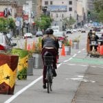
Also along the industrial waterfront, MUNI is in the process of extending service along a new Third Street Light Rail Corridor. The line will cross the Fourth Street Bridge and run along Third Street and Bayshore Boulevard, ending at the Bayshore Caltrain Station in Visitacion Valley. Tracks will be constructed primarily in the center of the street to improve safety and reliability and 19 stops will be provided. This phase of the light rail project is expected to open for service in 2004. Phase II of the project, for which no timetable has been set, plans to extend rail service north from the Fourth Street Caltrain Station under Market Street and into Chinatown.
Some recent projects and policies that Urban Ecology has endorsed include:
7th & King
Folsom & Dore
Stonestown Village
Presidio Trust Improvement Plan
Fair Share Housing
San Francisco’s projected housing need from 1999-2006 according to the Association of Bay Area Governments is:
Need Categories* Household Income Level Number of Units
Very Low Income (up to 50%) up to $31,650 5,244
Low Income
(50-80%)
$31,651-$50,640 2,126
Moderate Income
(80-120%)
$50,641-$75,960 5,639
Above Moderate Income (>120%) >$75,960 7,363
Total Projected Need 20,372
Average Yearly Need 2,716
Approval Process & City Contacts
Proposed development first goes to the Building Department, and next to the Planning Department. If the project is complicated and cannot be immediately approved, the proposal is passed to the planning staff for further review. At this stage, it is given to one of four teams (each team is responsible for a geographic quadrant of the city) and scrutinized to ensure it passes standards of occupancy, design, use, etc. If complications arise in subjective categories such as design, the planners and developer meet and negotiate a settlement. If the building is a historical landmark, it receives special attention from the historical specialist on each team.
The Planning Department is located at 1660 Mission Street, San Francisco, Ca. 94103. Central phone numbers are: the Planning Information Center 558-6377 ; central reception 558-6378; fax 558-6409 (fifth floor) or 558-6426 (fourth floor). Most questions of a general nature related to Planning can be answered by calling the information counter, including identifying planning staff assigned to active cases or permits.